The land surveying industry is undergoing a digital revolution, and at the forefront are point clouds and Gaussian splats. These advanced technologies are transforming how we capture, analyze, and visualize terrain data—especially in complex environments like Costa Rica's diverse landscapes.
What Are Point Clouds?
Point clouds are massive collections of 3D data points captured by LiDAR scanners, photogrammetry, or other surveying equipment. Each point has X, Y, and Z coordinates, and often includes additional data like color, intensity, or classification.
Traditional Point Clouds
- Billions of individual points
- Large file sizes (GBs to TBs)
- Require specialized software
- Limited real-time visualization
Modern Point Clouds
- Intelligent data structures
- Compressed formats
- Web-based visualization
- Real-time interaction
The Gaussian Splatting Revolution
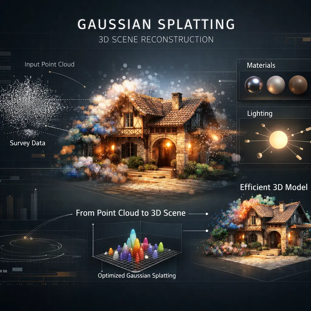
Gaussian splatting is a breakthrough technique that converts dense point clouds into efficient, photorealistic 3D models. Instead of storing billions of individual points, Gaussian splats represent surfaces as overlapping 3D Gaussian distributions—mathematical functions that can be rendered efficiently while maintaining visual quality.
Key Innovation: 90%+ Data Compression
Gaussian splats can reduce point cloud data size by over 90% while maintaining visual fidelity. This makes it possible to stream and interact with complex 3D models on standard web browsers and mobile devices.
Applications in Costa Rica Surveying
Real Estate Marketing
Interactive 3D property tours for remote buyers
Construction Planning
Virtual site analysis and development simulation
Environmental Assessment
Forest canopy analysis and terrain modeling
Legal Documentation
Precise boundary visualization for property disputes
Technical Advantages for Costa Rica's Terrain
1. Vegetation Penetration
Costa Rica's dense forests pose challenges for traditional surveying. Gaussian splats derived from LiDAR data can separate ground points from vegetation, creating accurate terrain models even in heavily forested areas.
2. Slope Analysis
The country's mountainous terrain requires precise slope calculations for construction feasibility. Gaussian splat models provide continuous surface representations that enable accurate slope and aspect analysis.
3. Water Flow Modeling
Understanding drainage patterns is crucial in Costa Rica's rainy climate. 3D models derived from point clouds allow for sophisticated hydrological analysis and flood risk assessment.
The Survey Costa Rica Workflow
- Data Acquisition: LiDAR drone flights capture billions of data points across your property
- Point Cloud Processing: Raw data is cleaned, classified, and organized
- Gaussian Splat Conversion: Point clouds are converted to efficient Gaussian representations
- Visualization Setup: Models are prepared for web-based interactive viewing
- Analysis & Delivery: Clients receive interactive 3D models and analytical reports
Case Study: Mountain Property in Monteverde
A 5-hectare property in Monteverde presented challenges with steep slopes and dense cloud forest vegetation. Traditional surveying would have taken weeks and provided limited data.
Our Solution: LiDAR drone survey captured 250 million data points in 2 hours. Gaussian splat conversion created an interactive 3D model accessible via web browser.
Results: The client could virtually explore their property, identify optimal building sites, analyze slope stability, and share the model with architects and engineers—all without visiting the site.
Cost-Benefit Analysis
Traditional Survey: $1,500, 3-week turnaround, 2D maps and limited data
Point Cloud + Gaussian Splats: $2,200, 1-week turnaround, interactive 3D model, terrain analysis, web access
The additional $700 investment saved an estimated $15,000 in avoided construction modifications and provided superior planning tools.
Future Developments
The technology continues to evolve rapidly:
- Real-time Processing: Near-instant conversion of LiDAR data to Gaussian splats
- Augmented Reality: Overlay 3D models on physical sites using AR glasses
- AI Integration: Automated feature detection and classification
- Multi-temporal Analysis: Compare changes over time for erosion monitoring or construction progress
Experience the Future of Surveying
See how point clouds and Gaussian splats can transform your property analysis. We offer demonstration models of Costa Rican terrain types so you can experience the technology firsthand.
Request a DemoOr get a quote for your property: